This is the Poliflash Magazine Archive for the years 2016-2022.
The articles of the current edition are available on the new site.
The articles of the current edition are available on the new site.

The activities of the GlacierLab of the Department of Environment, Land and Infrastructure Engineering in the framework of the climate_change@polito project continue. From 18th to 20th July 2022, a group of researchers reached the Rutor glacier (in La Thuile – Valle d’Aosta - Italy) once again, together with experts from ARPA Valle d'Aosta, to carry out new surveys to study the situation of this precious natural environment and to evaluate the possible downstream effects, e.g. in artificial reservoirs.
The activity, besides allowing constant monitoring of the glacier, is based on a multidisciplinary approach to analyze the hydro-morphological evolution of the proglacial zone, i.e. that land that has been freed from ice in recent times. The monitoring of the retreat of the glacier and its mass balance is important mainly because it quantifies the forcing that triggers the phenomena of deposition and erosion of the proglacial zone and the continuous formation of bare soil, with consequent advancement of vegetation. This is the most innovative aspect of the ongoing research, carried out as part of the Glacier Lab within the project climate_change@polito, which led to the inclusion of DIATI in the list of the "Departments of Excellence" outlined by the Italian Ministry of Research (2018-2022).
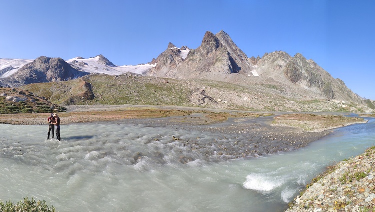
The analysis of the periglacial zone is still at an early stage because measurements require multiannual repetitions, but one of the main goals is to set the water and solid (sediment) balance of the entire proglacial area, in order to understand when and where this area behaves as a sediment accumulator and when as an emitter. Water flow measurements are capillary, and not just at the glacier mouth, and a turbidimeter has been added to measure suspended solid transport, while geomatics measurements are extended to the entire area. In addition, the week prior to the expedition, thanks to the collaboration with the Free University of Bozen and CNR-IRPI - Padua, our colleague Velio Coviello installed a number of geophones to capture the "noise" produced by the gravelly sediments moving at the bottom of the stream close to the glacier outlet.
The new measurements made during the expedition – that involved Alberto Cina, Stefania Tamea, Carlo Camporeale, Fabio Giulio Tonolo, Andrea Ajmar, Paolo Maschio, Nives Grasso, Elisabetta Corte, Myrta Macelloni, Valeria Longhi from Politecnico di Torino and Umberto Morra di Cella and Michel Isabellon from ARPA Valle d'Aosta - will be compared with the 3D models made in the years 2020 and 2021 over the entire basin and the measurements made historically by ARPA VdA.


